Showing posts with label Hiking. Show all posts

Sunday, July 19

The West's Gift to the World

I did not go hiking for the third week. Why? This damn ugly, polluted and hot weather doesn't allow a good sleep, so despite the fact that I wake up when the clock goes off at early hours, I'm so freaking tired that I can't even get out of the damn bed. I hardly can get out of the damn bed even during the week but I do as I have to go to work.
There was a program on CBC 1 (AM 1010) about the poor asthmatic children whose lives are in danger now. This program was about the B. C. Interior, and I think one of them has already passed away as a result of extreme air pollution in the region. So sad but who's fault is that? Every issue we have in the world is the fault of the greedy Western companies. Their non-stop hunger for money has brought the universe to the position that many environmental scientists believe there's no cure for it. Who introduced plastic to the world and have been using it non-stop in every aspect of life? They introduce a ridiculous law at different levels of the governments and think they have done plenty. They have banned plastic bags from groceries and many opposed that at government levels at the time I remember, and then they repealed it. What a bunch of filthy disgusting, nasty, sewer rats! Then you go to a freaking supermarket and there are thousands of, literally, thousands of disgusting nasty, filthy, vomit causing, processed food items wrapped and bagged in several layers of plastic! That's how they protect the environment. They have wars all around the world and imagine how much waste and how much smoke and other health threatening items are going into the atmosphere every year. Who has started or lengthened the wars in Ukraine, Iran, Sudan, Yemen (all current) and Afghanistan, Iraq and Syria?! 
They do nothing or minimum and brag about it. I hope the temperatures drop at least a little in the few next days so I can go hiking. 
(Photo: This little storm pond is close by. I went for a half an hour running around it. It is so peaceful and there's barely anyone there and there's a nice breath. You don't even feel the heat!)

Sunday, June 21

Mist Mountain, Not Finished

I checked the weather all around Alberta starting this past Tue. to see where I could have my first 2026 hike. I eventually selected Kananaskis Country. Not only because it's close but also because my pass is still valid. I have done hikes there in the days when no pass was required. Now you have to pay for everything and gasoline price is high. Although I need to check this Canada Strong Pass for the time I'm going top a National Park
I set the alarm for 04:00 and then changed it to 04:30 before going to sleep! When it went off, I woke up easily but was not sure whether I should go or not! I laid down and then got the hell out of the bed, grabbed my gear and headed to Highway #1. I needed to buy some gas because I had been too lazy to buy it the night before. I stopped at a Shell gas station on Country Hill Boulevard, I think it was $1.669, then I drove deeper south, on 16th Ave., which is an extension of TransCanada Highway (and I never knew why they did that!) it was about $1.560. When I got to the intersection of Highway #1 and Highway #40, where the big casino and all the other Indigenous people's businesses are located, it was around $1.760!
The Mist Mountain trail-head is deep in Kananaskis Country. You need to pass Highwood Pass and drive for another 10 km. When I reached there it was almost 07:30, meaning from home to the trail-head took 2 freaking hours and a half! I stopped for gasoline and a coffee, of course but still it's too long. This time, despite my first attempt which was last year, and I didn't even go up because it was raining! (another stupid excuse!) I was able to find the trail, using my handheld GPS. I will write about this stupid and useless device later to everyone who buy something like that to simply save them some dollars! The trail goes through the three and it's steep and then you come out and walk beside a creek and it becomes steeper! I was almost at 1 hour when I saw three people coming down, which is always a good thing. I was told that unless I had crampons, I would not be able to pass the snow pack and it would be very risky. Good advice. 
Recent precipitation has created a beautiful green lush in the area
At  01:15 I was on a ridge with good views and could see what the guys were talking about. I was tired anyway and the excuse saved me! I spent around 15 minutes on the ridge and headed back down. The rest of the trail which would go to the Hot Spring didn't seem too hard, if someone was well equipped but I will see that the next time I try it. The funny thing is Scottie wanted to go with me and despite the fact that I know he's full of shit, if he ever says he wants to join, I will take him but with separate vehicles. So when he's stuck like a stupid mule, I'll leave him there! People like that deserve this!  
This time I tried to climb light. I didn't take any water bottle and my hydration pack was only three quarter full. Luckily it was not too hot, as drinking out of a tube is not very pleasant. They say the plastic that forms the pack is somehow get mixed with the water due to chemical reactions! So basically you're drinking poisoned water! I don't think that's untrue! You can taste the plastic in the water but it can't be worse than majority of the food that people eat or the beverages that they drink on daily basis! 
I had read that reaching the summit requires gaining a significant elevation of 1300 m (from the road, of course), which equals to 4265'! It's not a little elevation and considering the summit sits at 3140 m (10301') it's not an easy hike (combined with scrambling) but I also read that most people don't bother going past the little pond of hot water, which is for the best. I have four weeks until my Kananaskis Pass expires! So I'm going to spend the next four weeks in that part of Alberta! No! I'm just joking. I'm not a cheapskate! I will make another attempt though, either the next week or the week after.
(Photo, top: The hike ended here on this ridge where you can see the trail continues in the snow. This is probably one third of the entire hike, if not less)

Saturday, December 27

A very Labourious Christmas Season

I booked a truck to go to Mt. Robson Provincial Park this holiday season and I'm really glad that I canceled it. That would have been suicidal! I basically haven't done much this past week or so but eating and shoveling snow this Christmas. Some people drink. I eat. Both are detrimental. Which one is worse?
When you don't do much, or at least it's me, you can't get a good sleep. I went to bed late last night. It must have been around 23:50. Woke up around, I think, it was 03:00 or something. Stayed up for an hour. Went back to sleep and woke up at around 09:05 to a -22 ℃ (-7.6 ℉) very windy day. That was when I realized: Damn! The pipe! The pipe is frozen and I'm going to be in trouble. There's a pipe which sticks out of the front of the house and takes the, I assume, vapours out of the heating system. If it is clogged, you're done! I learnt that from a neighbour! She has helped with that in the last two years or so but she was not here this year! So I rushed and got my ladder. Set it up and started banging on the damn pipe. The temperature inside showed 14.5 ℃ (58.1 ℉)! from the 16.5 ℃ (67.1 ℉) which I had it set (I know it sounds insane to many, but I'm fine with that). I don't know why that was! The system might have been confused! I started hitting the damn pipe with everything I had in my possession, as I said and eventually it was clear. Went back inside and the temperature was back up to the set. I had to take a shower after all that as I also shoveled the front for almost half an hour. 
(Photo: Winter is really beautiful here in Alberta. Took this during a short walk close to home)

Wednesday, September 3

Trip to NV at Trump's Time (3): Boundary Peak Attempt

Sleeping in Mizpah Hotel was not too bad but I didn't have enough stimulation the morning I woke up! I made myself a cup of coffee in the room before checking out and headed west. I took US 95, a major highway in Nevada which although goes from south (Las Vegas and before) to north (Reno and beyond), runs from east to west when you exit Tonopah and aim for Boundary Peak
It was a bit scary but not a kind of fear that a coward feels. A fear that someone who is alone and suspects they will be in a hole, feels. I continued on US 95 until I reached US 6 which continues to the west and then turns south. This time the number of vehicles on the road decreased even more! 
I drove until I reached Queen Canyon Road, a gravel narrow pass which takes you to an abandoned mine. It took painfully long. Both because I was by myself and it was hot. I started going up. Nissan Kicks is a sort of small SUV which does not have much clearance and it was then where I realized that I had made a mistake! I had selected the wrong time of the year and going there alone was a very hick risk especially when you drive a tiny little car. If the vehicle breaks down or you get injured the chances you come out alive are next to zero! One might ask why there's a road there? The answer can be seen at the end of the very same road: There used to be an active mine there. We saw the mine the last time I was there with Alphonse a few years ago. This time, though, I didn't even make it to the mine entrance! I was terrified that something might happen to the damn car and that would be the start of a very miserable day!
I don't know how far I was from the sort of parking area in front of one of the entrances to the mine but I found somewhere that I could turn and headed back. 
I know this is so stupid and idiotic but there was a huge risk involved and that would not have been even because of the climb! I felt very bad but while I was going back to Las Vegas, I planned for another trip, hopefully next year, to do the hike but this time from the California side. Here's one plan:
1) Fly to Sacramento.
2) Drive to Hawthorne, NV. It's longer than driving from Las Vegas to Tonopah but the drive will be a new one for me and I won't get bored.
3) Drive to Queen Canyon Road.
4) Do the hike.
5) Buy a reliable Satellite Phone, obviously before the trip starts! In case something happens you can contact an emergency, unless the incident is so bad that you can't use the phone! 
This hike would be perfect, if combined with a trip to Japan because there're flights from San Francisco but I think my next year long trip plan is set for Europe, not Japan. So unless there's another opportunity to make the trip to northern California happen, the hike cannot be done.
(Photo: Boundary Peak, the third one from right, not seen the tallest, from the intersection of US 6 and Queen Canyon Road)

Tuesday, July 1

More Excuses for Thrift Peak

When someone fails to reach their goal, there are usually many excuses and blames. I'm not excluded! Here's the story of how I failed to reach the summit of Thrift Peak, again, yesterday. I'm sure it will be helpful for the ones who would like to visit this extremely beautiful area of the province and even if they have no plan to go, I hope they enjoy reading this post:
I woke up at 04:00 o'clock in the morning of the 29th and headed south on Highway #2 but turned back before reaching the city outskirts due to lack of confidence! As stupid and insane it might sound and it is, that's what I did. Then I went for my jogging and spent the rest of the day doing different things. I told myself that I would have to do the summit so, again, set up the alarm clock for 04:00 and woke up at that time and headed south again. I only had a quarter of tank gasoline and instead of filling the tank shortly after leaving home, I drove all the way until my stupid and old GPS, which I had turned on to show me the nearest gas station told me to go back to Southland Dr. It would have taken at least 16 minutes! Now at this point the time must be around 04:40 and I know the GPS is full of crap so I go to 130th. Both the damn Shell and Mobil gas station are closed!! So now I'm going further north to 114th to get gasoline. Here I lose at least half an hour, if not more.
My next stop is in Okotoks for a coffee but who has coffee around 05:00? McDonald's. Despite the acceptable quality, McDonald's service is always shit! So here is another 15 minutes or so lost! On the top of that and in order to get to Longview, which is the next destination, although I had no plan to stop there, the GPS, again, took me from an unconventional(!) road and added more to my anger and anxiety! 
By the time I reached the trailhead, geared up and was ready to go, it was 08:10! four freaking hours for a trip which shall not take more than 02:30, maximum! There's no doubt that my old vehicle is a contributor to this. Considering it was a working day for many, there was only one vehicle in the parking lot. It was a beautiful day and it was about to get hot but the trail was so green and wildflowers were seen everywhere. My first setback was when I walked up a big sort of rock and then I realized that I should have walked around to get me to a ridge! That wasted at least half an hour and then continued on a ridge with a drop-down on the left. I was very tired and it was really hot. I had to stop every half an hour or so to drink water and I was trying to preserve it as I didn't have much and there was no water on the trail. Another mistake was bringing the crampons! They were unnecessary wight in the backpack. All of these could simply have been prevented, had I been at the trailhead around 06:00, instead of 08:10! 
Despite the heat the area was green and covered in beautiful flowers
I then reached the spot where I think I could see the fire lookout and it was pretty far! It was around 12:15 or so, 4 hours of hiking and I was at a point where I had to go down and then take a ridge to get myself to the main ridge that leads to the summit! I was very tired and hot and I think for someone in my position, it would have taken at least 2 hours to get to the summit! Then add another half an hour at the summit and at least 5 hours to get back to the car. It would have been 18:00 and I would have had time but the combination of high temperature, exhaustion, lack of water and lack of confidence led to me going back. Besides there was absolutely no one in a 5 km vicinity or bigger and that's always the issue when you hike in a remote area. 
This was the fourth(!) serious attempt that I was hoping to accomplish the mission but I failed again. Now whether I will be in the area or not, is another question which I will answer by saying Yes! Here's my list for a successful hike to that peak:
1) Start at the trailhead no later than 06:00. Stout and I were supposed to have a tent set up in the parking lot or somewhere to be able to start early but I lost my contact with him and I don't think this is legal. Besides lack of water and other services and the isolation are other issues.
2) Drink lots of water and other healthy liquids before the start of the hike, have as much as you can on and store a lot in the vehicle for your arrival. Water is the biggest issue in this hike. I had a Coleman water backpack which was not very helpful. Nothing against it but I think I should have sucked(!) so strongly and I didn't! So I had to open the top and drink from there.
3) Food has never been a problem for me during hiking but perhaps if I had something fresh and easy to digest and absorb, it would have changed my mood because sometimes it's emotional. I had a handful of Almonds and a few Dates from last year(!) still in the backpack. I finish 3/4 of that.
4) Don't haul unnecessary weight. It will be a problem when you start feeling tired. 
I have to see when will be the first opportunity to try this peak again. 
(Photo, top: On a beautiful sunny day the fire lookout could be seen from the beginning of the hike, after, probably 30 minutes or so. Here in this picture it barely can be seen on the third peak from right)

Sunday, April 13

Out After 10 Years (23): Fujiyama

 Climbing, or perhaps I shall say, hiking Mt. Fujiyama was part of my trip to Japan until I realized that I had to register and it was too late. Now I have my second ticket to Narita purchased but with the current employment status I won't be able to go until, the earliest, in 2026. Then after reading all the crowds and hassle about registration and booking a nice and comfortable place nearby, I thought I should perhaps to switch to another hike in that country as there're many available and all as beautiful or even nicer than Fuji.This mountain has always been the symbol of Japan and there's barely any picture, clip, book or advertisement that do  not contain a snow-covered mountain in it and the Japanese are proud of that. The recent climate change has resulted in this always covered mountain to lose its glory, recently! I read about it when I came back from my trip and then I went back to my pictures and looked. I passed Mt. Fuji four times and took a few photos while on Shinkansen. Why did I not notice that or mention it in my notes? 
Here it is, you can see it in the top photo and I will write whether I hike or not, the next time I go to Japan. Mt. Fuji is considered scared and has respect in Japanese culture. I think the climbing was banned at a point due to erosion and that's most likely why they require climbers to register. They not only intend to limit the number of hikers but probably want to screen them. I think there's a section in the form which asks about the experience and stuff of that nature. They even have built a website for that and there's lots of shit to go through to be able to do the climb but many do that just to simply say they have climbed Mt. Fuji! I even read that many start early to see the sunrise from the summit(!) something that I hate to do! I always start my hike early but not because I care about the damn sunset! I wonder what would happen when I'm going up and seeing flocks of people coming back down! The other thing is I would like to do it during the off-season and I hope there's no limitation. I would like to do it in late Sep. and then continue with the rest of my journey but all I need to do is to climb and hike as many mountains as possible this summer and fall. I haven't had a good ascend for a long time and that is the only way I can prove to myself and the Japanese that I can do Fuji as well, if I ever decide to. 
(Photo, top: Mt. Fujiyama without snow. This has been taken from the train and you can see the reflection in the window. I think it was taken when I was going back to Tokyo from Nagoya) 

Wednesday, January 15

The 2025 Plan: 2) Hiking

2024 was a very bad year in regards to hiking. I had at least 4 attempts and never reached a summit. Now with low dollar, I think I shall cancel the European trip and simply focus on local hiking but the first on the list would be the failed attempts

1) Abraham Mountain

2) Stegosaurus Mountain! (Known as Dolomite Peak in Canada!)

3) Thrift Peak (This one I have tried at least 5 times so far, if not more!)

4) The Wedge (Was attempted, probably before 2017 or sometime around that year, the last!)

5) Big Sister (Tried once dangerous and hard hike)

6) Black Tusk (This one is B. C. Need more funds for that. Was tried once back in 2016, I think)  

7) Boundary Peak (Nevada. I need to get this out of my head as well)

8) Mount Burns.

I think this is enough and if I can reach the summit of all, it'd be a big accomplishment but I know it won't be easy, especially solo. While most of my good hikes have been solo, having somebody at the side creates a sense of competition and at time security in case something happens. I was all by myself in six out of eight of the above hike. 
(Photo: A small herd of Mountain Goats. This was in 2015 and the air as might be able to see, in the background, was nasty. This is happens to the world where nasty animals who only think about money, take control: Motherfucker Capitalists of Western world) 

Monday, September 2

How a Loser's Life Turns Out

I had a flight booked to Las Vegas this past Sat. at 08:00. I even had paid for my seats, going and returning. My plan was to go to Tonopah to do the hike that we tried nearly two years ago and failed miserably! I was not ready for the trip, generally. So I set my clock for 05:55, woke up, had something and head out. By the time I reached the airport, parked and went to the gate, it was almost 07:10 and I was told that the checking had been closed! I went back home! Wasted at least $600, if not more. I had booked the ticket in May!
Then I told myself I had to do something positive with my time at least this Sun. So I headed to work. I reached there at around 09:00 and after a few minutes of work I realized that our network where I needed to access my files was done! The filthy disgusting, nasty incompetent stupid Latino in charge of the network, computers and everything related had messed up! Imagine a company which is so pathetic to use a Latino as his computer and network system person! I spent a few hours and returned home with disgust and disappointment. Wasted the rest of the day. 
Then I told myself, at least I will use the best of Mon. So I set the clock for 04:30 to head south for a hike. Woke up and couldn't convince myself to get out! Ate something and went back to the bed until 07:30 or so! 
(Photo: I stayed in Conrad the last time I was in Las Vegas. A nice and clean place)

Tuesday, July 16

Stegosaurus Mountain

The weekend before the last one's failure in Abraham Mountain did not discourage me. It was very hot and I had started started late. This past weekend, I made some changes to my plan which although did not result in summiting a mountain I had planned but made significant improvements. My failure in reaching the summit had other reasons which I will explain but first what I did to help myself to have a better hike, although it was barely a hike. It was a scramble 90% of the route! This mountain is called Dolomite Peak, and is located in Icefield Parkway I would like to call it Stegosaurus Mountain:
1) I started earlier. It was not because I left home earlier! It was because it was closer! In fact I had a hard time getting out of the damn bed when the clock went off but I did it anyway and after a long drive, shorter than the previous one, I started the hike at almost 08:20.
2) Left almost every damn heavy and annoying thing at home: It was including the mobile charging device, this is very heavy, bottles of water, crampons, I knew I wouldn't need them,  the very useless Valard backpack with its stupid straps. I made sure I left it at one of these donation boxes at the side of the street! 
Stegosaurus fossil. 
3) Took enough water! One might ask how I managed to do that while I was not carrying any bottles! I used my Coleman backpack which worked great. Light. distributes the weight on your back evenly and has three adjustable straps. 
With that said, I started at about 08:20, as I indicated. The trailhead is located shortly after you enter Highway # 93 from High #1, going north and is located next to a bridge over Helen Creek. You won't miss it. The temperature, at the time of the start, to my surprise was only 8 ℃ (~ 46 ℉) which is great for this time of the year. I could have started earlier but made a mistake by stopping at Lake Louise for a coffee where I saw the only coffee shop in the so-called village packed! I simply turned around and kept going. That easily wasted 10 minutes, if not more. The hike starts from a very beautiful trail which is very steep and might discourage many but then becomes flat and goes down and reaches a stream or creek where you need to cross. I wasted a little time over there as well but eventually got into the water and passed! the tree trunk was not much helpful to me! I then continued basically toward north and northeast, parallel to the creek where my map said to either keep going to the north end of the mountain or try to go up from a drainage of the mountain on my right. The northern path looked easier but longer and I chose that. From the it was all up at an angle of nearly 40° but very beautiful, carpeted in wild colourful flowers. I didn't mind it and kept going up with no hiking poll and no helmet until Bow Lake, at the south side of Highway #93 N could be seen. It was almost 3 hours from the start and I knew that I had at least 1 more hour to go to reach one of the peaks but It was very exposed and I was worried that I might fall and break my life to pieces! So I turned back down from there.
Bow Lake and its beautiful blue
It was a good exercise but I still am tired after 2 days! It's considered a hard scramble/hike which cannot be done by everyone but I will give it another try hopefully before the hiking season ends because know I know what I will have to do. The question remains about the name of the mountain. Here is how this name was created! I took a coupe of panorama shots from the mountain using my mobile phone as I have decided not to take the phone any more and used one of them as my desktop background. A colleague saw that and called it a dinosaur mountain. It really looks like the back of this specific dinosaur called Stegosaurus if you look at the picture on the top! So I have this plan to change the official name when I can. 
(Photo, top: The sleeping Stegosaurus from the valley, next to the creek. My approach was from the left side of the photo)

Monday, July 8

Should I Forget Hiking for Good?!

I decided to give Abraham Mountain another try after almost 2 years, yesterday. So I woke up at 04:30 and then like a lazy loser I wonder if I shall go or not! I decided to go eventually and headed north on Q. E. II. By the time I reached the outskirts of Red Deer and wanted to get a cup of coffee, it was almost 05:50(!) and had to wait until the damn McDonald's open! Then I headed east and of course it felt longer because there was nobody next to me to yap nonsense and I tried to keep myself buy with music until I reached Nordegg. I had to use the washroom and I'm sorry to say that but that happens every time I attempt a hike! I get a coffee and in half an hour I have to pull over into someplace because the coffee does its job!
I, then, was able to start the hike almost at 09:00, only 1 hours earlier than the last time, which soon I realized it was not much better! I think it was a different route this time because very soon I realized that I needed my gloves and they're not regular gloves for cold because it was not cold, of course. They were sort of gripping gloves like motorcycle gloves, perhaps I can say. The sharp surface of rock would have ripped my hands to pieces, had I not worn them. I soon realized why Alphonso opted out after only half an hour, the last time but I kept going. At that point I was quite confident that I was able to keep going but then I hit a few dead-ends and exposed areas and had to claim back down and I thought I shall take a break. Knowing that I only had a small can, I drank a few drops, adjusted the stupid backpack, which I will rid off soon, because it's useless and continued going.
Wood Lily is common in the area at low elevations
It only took another hour until I realized that I cannot carry on with the hike any more! It was really hot and the damn heavy backpack was bothering me a lot. I was sweating and breathing heavily and that was it! Coming back down was no fun either but by the time I was at the vehicle again it, almost 04:15 hours since my departure and I had finished the water!
If you really want to complete this hike avoid the mistakes I made:

1) Start as early as you can. I'd say 05:00 from the trailhead. For that you either to have the night in Nordegg or in a camp area close by or you have to drive a long distance like I did and screwed the hike! 

2) Pack as light as possible. Next time I'm going I'm taking water, a very small bag of snacks, maybe 100 g. and spare windbreaker.

3) Have enough water and good beverages ready in the vehicle for the time you're returning. 
(Photo: Abraham Lake from the 2-hour point of the hike. At this stage you have nearly one third of the hike only!)

Tuesday, May 7

Cursed (I don't believe in it!)

Have you seen the people who bring excuses for everything they mess up?! I have! I was on Highway #22 again this past weekend on my way to Bob Creek to bag Thrift Peak and was listening to the news. I learnt that Toronto Maple Leafs just had lost to Boston Bruins in gave 7 and was eliminated. There was this guy who was saying: We are cursed! 
What kind of stupid nonsense is that?! Why don't you simply admit that the opponent played better and kicked your ass?! Then you can focus on the next season and perhaps come up with a plan to beat them or simply play as hard as you can despite the fact that you most likely cannot beat them! 
Now going back to my the second trip to Bob Creek in the current year, so far: I can say that I was quite confident. I rented a Frod F-150 to be sure that I won't get stock in the gravel road and woke up quite early. This trip was filled with weird things! First of all when I pulled into the trailhead's parking lot, I think, I saw the same two trucks that I had seen the previous week! I thought to myself: How could that happen?! The guys have been lost in the woods for a week and no one has come for them?! 
Then I started my hike under the cloudy sky. One usually reaches a set of short rocks after a little more than one hour. This time I saw someone from distance. A guy in hoody. What came to my mind was the stories of the hikers who had been killed in the US, at that moment! I thought to myself what if this guy has a gun and shoots me while I was closing! Nothing! I'll be done and there's nothing I can do and the knife is not even useful! I usually carry this long knife and I don't know why! Probably because I've paid for it! I'm just waiting for a morning that I walk into a coffee shop on my way to a trailhead with this thing hanging from my side and someone says something to me or call the police! So I kept going and I think the guy either didn't notice me or simply ignored me. 
I continued and passed the creek twice and got myself on the trail going up the hill at this point I saw a few White Tail Deer but they noticed me even I could get my camera ready. They disappeared in the woods. Then I saw a big house-like tent on my left or perhaps I shall say at the west side of the trail. This was not there last year I was going up with Stout. I decided to sneak by before triggering anyone to come out and shoot me in the middle of nowhere! 
It looked like bears or one bear, I don't know how many of them are there, were active in the area. This paws print a few more was seen on the fresh snow, possibly, from the day before. I also saw a leg, a deer's leg perhaps. The rest had been used as a meal, most likely
The trail took a strange turn at that point when I went a few meters higher and I found it difficult to follow. Not only because there was no sign of it anywhere but on my GPS but also because of the snow on the ground. I was hoping that I could see the damn lookout but looking around the foggy mountains showed nothing. I decided go back to the trail and that was when I realized the pair of boots I had on, instead of the heavy work boots of the last week, were not good either! The snow started at that moment and I decided to go back down! 
When I got back to the main trail in the valley the snow had turned to rain when I reached the rock, I realized the guy or guys had left. I walked the rest of the trail in the rain. It was a little passed 06:00 hours by the time I reached the parking lot. The two trucks were gone! So it's possible that the tent-rock guys were the owners of the trucks. 
(Photo, top: This hut/tent in the middle of the woods freaks me out! Who the hell builds a home in the middle of nowhere and how do they live there?! I didn't dare closing and passed by quietly. The closest community to this area is Pincher Creek. It would take someone at least 1 hour to get there in a normal day)

Tuesday, April 30

Old or Lazy?

I decided to continue this year's hiking by going to Bob Creek this past weekend, with the hope that I can finally go up Thrift Peak. It seemed easy but I didn't succeed, again! That was my forth attempt! before getting to the story, I have to say that I asked this question from myself, on my way back: Am I getting lazy or old?! 
Then I answered myself by saying:
1) I had not hiked in a remote area for such a long time. So for that reason my confidence level was low. If anything happens to someone in the area, while hiking, the chances that he survives is very slim because:
    a) There's no cellphone coverage.
    b) There are not many hikers in the area
    c) The closest clinic is probably the one in Diamond Valley which is 01:30 hours away
2) I put my safety boots(!) on which felt comfortable and nice at the beginning but after more than an hour I felt its weight! It's a little big for me which means it's okay to wear them at work but not for a +07:00 hours hike!
3) I am always organized and make a list a few days before my hike. I forgot my sunglasses on the day and it happened to be a very sunny and beautiful day.
With that said, I work up at 04:30 and headed out drove slowly to south. I had rented an SUV the night before, considering my own vehicle is not in a shape to be driven that long. Driving a new vehicle in early morning cold and dark day for someone with low self-steam means driving around 80 Km per hour! I stopped at a McDonald's for a coffee in Okotoks and that was the second problem! Why, you might ask. Because coffee helps to go to bathroom, particularly for someone who had some Eggplant (Aubergine as the British would say) dish the night before! I was about to explode until I finally pulled over into Chain Lakes Provincial Park
This pair of paws print look really real. I just don't understand why a bear would walk on a trail on such a low elevation!
By the time I reached the parking lot of the hiking area, it was almost 08:30, I think. It took me one hour extra! There was only a truck there and later was joined by another who happen to be a group of three hunters who took a different trail than I did. 
I had taken the trail more than a year ago with Stout accompanying me which lead to its own story so I knew where I was going. However, in order to be sure and not get lost again(!) I had my GPS handy and had bought a pack of four rechargeable batteries for it, the night before. The weather was not, only a little windy and there was no one but one I finish my way north and started heading west to get top the point that I would reach the trail marked on the GPS map, I realized something like a Bear's footprint! Why did I say it looked like a paw print because out of 10 or more that I saw only a couple looked real. One might ask what that means?! It means that I suspect someone wanted to joke with people and made fake paw prints because bear usually do not appear at such a low elevation and certainly not on a trail! I kept going with the hope that it was a silly joke but kept my eyes open. By then I had waked for nearly an hour and half and crossed the creek once but then I realized that I had to cross again and this time it was not easy! The water was deep and I had become tired! My boots were bothering me and my backpack felt heavy. My eyes was hurt because of the sun and my skin started burning! I wasted nearly half and hour wandering around the creek to find a spot to be able to cross it and eventually went back to the first spot and here is the interesting part: I tripped over a branch and took a dive head first but contained myself and only injured my knee a little bit! Then after crossing the creek I decided to go back!  
There's not much to say about the hike back to the parking lot rather than the fact that I hated the safety boots more! The entire hike took about  03:52 hours and there I promised myself to get back next week.
(Photo, top: This looks like a beaver-made dam on the creek)

Sunday, April 7

Indian Canyon and some Businesses in Palm Springs

 My third goal in my short southern California trip was a native land which has been partially turned to a park: Indian Canyon. I was one of the first vehicles entering the park, considering it was Sun. and everyone was still asleep! This place has several trails is is surrounded by mountains by unfortunately I didn't have enough time to spend there. Rain was another issue which started after almost 1 hour to an easy hike. I decided to go back as I don't like this sort of nerve racking situation, especially because my flight had been scheduled for the afternoon and had to be there in the airport 2 hours ahead of the flight which is most of the time unnecessary!  
The other problem was the vehicle. My rental, despite being a good brand and good model had a problem and I don't want to name the renting company because that was not certainly their fault. It seemed to be a problem with either the battery or the starter, although it could've been anything else as the new vehicle have computer and electronic systems. The pick up truck refused to turn on and it happened at least 4 or 5 time when I went here and there, especially when I left the park to get something to eat. 
I checked 4 businesses during my short stay: Ralph's, Jensen's Finest Food, Stater Bros Market, Koofi and one convenience Store which I don't recall its name. It was interesting to me that a small town has three different brand of supermarket and that is in addition to Wal-Mart that these days you can see in any North American city, if not everywhere in the world! 
The quality and price of the said stores are sorted from the top to bottom, in case you end up in Palm Spring and would like to buy something:
 
1) Jensen's Finest Food: It truly is the finest. If you drive something less than a VW SUV, you'd better not go to this store! Most of the vehicles I saw there, were either high-end models of top brands or today's EV that not everyone is able to afford. Everything is top quality and priced accordingly. I just bought bar for some $4 and that was good. I think it was on sale or something.

2) Ralph's: It's part of Kruger family. It was jammed pack the first time I was there and prices were reasonable. However I only bought to small pieces bread for $1!

3) Stater Bros Market: It looks like a place that mostly Hispanic, Black and lower income people would go there. I didn't buy anything, not because it looked cheap. I simply didn't find anything appealing. 
Now going to Koofi which seems to a major coffee brand in Palm Spring, was a disappointing experience for me. It seems that the franchise has at least 3 locations in the town but whether they have other ones in California or elsewhere, I don't know. 
How hungry should you be to eat this so-called wrap? The price is in US Dollars and it is presented in one of the Koofi location in Palm Spring, California. There are people who make only a few dollars more after working 1 full hour and there are people who spend way more than this on a lunch or breakfast without wondering. I'm neither of them and despite the fact that I totally understand today's inflation and cost of running a business, I can't eat something like this, no matter how hungry I am.
I checked out the one close to my hotel as it was only 5 minutes walk. It's a small place with tables outside as well. The first thing is they close at 17:30 or something, assuming people don't drink coffee at that time of the day but they could have extended their menu to have longer hours. The other thing is despite the quality of the coffee which is good but not superb, they have a limited menu with skyrocketing prices! One thing must be added here is that apparently taxes are high in this town because I also saw that a medium glass of Orange Juice in McDonald's cost nearly $4! So, it shall be consider that California and specifically Palm Spring are expensive places. 
Palm Spring is such a beautiful place and had I done my hike, I would have enjoyed my trip much more. Not to mention that the continuous rain was really nerve racking when it was coming down. Will I go there again? If I plan for San Jacinto, I thing PSP is the closest unless Alphonse says he would join and agrees to drive from LAX.
(Photo, top: Palm trees in Indian Canyon in southern part of Palm Spring on an Indian Reserve)

Thursday, February 16

Thrift Peak in Feb.

Stout surprised me by saying that he wanted to finish the hike of Thrift Peak with me, this past week! We had an attempt last year which led to getting lost in the woods and he panicking! Later he thanked me for getting him out and back home to his family, alive, although we got home 5 hours later that the scheduled time! I agreed to his suggestion and we headed south on Highway #22 in an unusually mild morning of Feb. 
This time I had my shiny GPSMAP 64® with me and despite the stupidity and negativity that Stout was emitting(!) I was hopeful to make the summit. We parked at the same exact spot that we had parked the last time, which led to the unsuccessful hike and getting lost(!) and followed the trail. The only difference this time was the fact that we had a clearer understanding of our area by using the GPS. Stout was trying to use an App he had installed on his phone and a silly little compass he had purchased but he didn't have a grasp of the App and the stupid compass was not working and eventually fell apart! Following the GPS we finally got on the actual trail and headed up on a steep trail but after a little while the strong wind hit us and when I say strong, I really mean strong! Neither of us are small guys. Stout must be at least 200 Lbs and I think I'm something around 175 Lbs but we were barely able to hold ourselves! A few meters up someone had made a shelter. Stout hunched over and started begging me(!) to go back down! He was worried to face the dark and get lost again! I thought he was right and it was not worth the risk and agreed to go back. It was almost 12:00 and we had about 3.6 Km to hike to reach the summit which would have taken anything from 1.5 to 2 hours depending the status of the trail, the exposure we would have to face and wind. 
Hill of Bob Creek Wildland where Thrift Peak is located. I like the blue sky in this photo
Our walk back to the parking spot didn't have anything special. We took a few pictures and we were just make sure that we are taking the same route that we had taken in the morning. 
We reached the car at about 15:46 and considering the hike had been started at 08:06, approximately, we finished our hike after 07:06 hours. We made a decision to go back and make it to the summit one later, soon! 
(Photo, top: Stout is dragging himself up in the strong wind, getting help from the hiking poles. We ended our hike somewhere close this spot)

Sunday, January 1

A Short Review of the Past Year: The Year of Failures!

January.01.2023. Morning. One more day and I will be back to hell! The disgusting job that I was given back in May of last year and is most likely will run out in a month of two! Let's quickly go through the past year and see if anything was gained. These are the plans for 2022:

1- Get the hell out of this shithole that I have been calling workplace for a little more than two years now.  I've had it with these fools. Get a real job. I got out. I have been making more but barely because of more hours that I had to put in! Beside, I worked outdoors, in extreme cold and intolerable heat. Not to mention that the number of assholes that I had to deal with with way more than the previous job. So overall was that better? Perhaps a tad better! 

2- Enter in a long-term and meaningful relationship. All my attempts failed. I have a separate post for that. Perhaps I should work harder or it's never going to happen for me! 

3- Travel outside Canada at least once. What a great accomplishment! I went to Nevada to do a hike and even that was a failure! 

4- Buy a new vehicle. Did not! The interest rate is so high and my desirable vehicle was not available. Once I wanted to order, the bastard tried to impose extra $3000 of different services and I gave up. 

5- Practice calm. Not achieved at all. It was so stressful at times and I made back mistakes simply because I was so tired and overwhelmed. 

6- Do as many hikes as possible. Overall I did 3 hikes and I failed in reaching the summit in all!

What a disastrous year 2022 was! At least I know what I should work on although with the price of everything going up, I don't believe it will be an easy year! 
(Photo: Snow is frozen to the branches of these short trees in Nose Hill Park, in Calgary. Did a short walk a few days ago)

Saturday, November 12

Disappointment in Nevada

This year which has less than 2 months to end has been quite disappointing in so many different aspects. I failed to get my CWB Level I Inspector Certificate, which is not a big deal and everyone can get it. I asked the Blue Eyed Lady out and she said no! and I had two miserable failed hikes! I have written about the first one and now I have to add another one: Boundary Peak
Boundary peak, as the name suggests is a mountain at Nevada-California border and we had a failed attempt this morning! Why? Because we selected a wrong time of the year and didn't have the right gear! We left the town of Tonopah early enough in the morning but there were two major issues which both stem from the same source: Snow! The piece of sh*t Ford SUV (Explorer ST) that we had rented and that was because Alphonse didn't feel like he should have driven his fancy Porsche SUV(!) was useless because it was skidding and then got stuck in snow like a stubborn mule in mud! We were lucky that we were able to get it out and parked it at the side of the very narrow road and walk up. 
Hiking up wouldn't have been the right decision because the snow was too much. Alphonse suggested to go up because he felt that we had come for nothing all this way. We went up for as high as 100 m. and then I decided to go back. I didn't want to walk in snow when I had no gaiter and even boots! We went back to Tonopah and had our lunch at Burger King. Then we checked the old cemetery and then our last stop was the mining park in the town. We thought now that we had failed our main goal then we shall at least see around the town. 
A view from the top of the hill which used to be the mine with both the Sate of Nevada and American flag
The mine at the time brought some glory to at-the-time struggling area. Gold, Silver, Lead and Copper for years brought wealth to the area which is estimated up to $2 Billion worth based on today's inflation. Unfortunately places such as this which as kilometers away from a major entertainment center (Las Vegas) don't get enough attention. How in the State of Nevada, which has a revenue of more $5.44 Billion, and that's all from different entertainments, would go to a small town, 3 hours northwest to see a mine which ceased its operation more than 100 years ago?!
Our dinner, which was after a break, mostly for Alphonse who wanted to have a nap, was served to us at this place called Hometown Pizza but that was a let down too! We were happy that the place had a Salad Bar and that was despite the fact that nothing, except two or three items looked very fresh, but when the Pizza was brought over and we each tried a slice there was nothing but the word bland. The sauce, the cheese and no other ingredients had taste. It was like your were chewing something without tasting anything. I'm not going to write more about the place but adding that you shall stay away. That a disappointing food experience added to a disappointing day! 
(Photo, top: This is part of the Queen Canyon road which takes you to the trail-head of the Boundary Head but we had to walk up due to the amount of the snow. The damn SUV was not going up)

Sunday, August 14

Dumb, Lazy and Fat!

Alphonse
was here last week and finally we were going to have a nice hike after a long time discussion and planning. Good? No! Not at all! It was an embarrassing failure!
He landed in YYC and I went to pick him up what I saw was quite shocking: He has turned himself to a fat-fuck who barely can walk! He was in shorts and shirts and like most people here in North America showed no shame! I would never be able to dress and walk in the public like that: A wrinkly stupid short above the knee which shows out-of-shape calves and big belly like a pig, shabby t-shirt to expose hairy arms, not clean-shaven and bald! How the fuck a decent and understanding man walk like that is beyond my imagination! We tried to rent a car but the bastards said either there was nothing available or they wanted us to rent for two days. I realized that we should have rented for two days, later! 

A small bottle of Gatorade, 591 ml, have you seen anything more ridiculous than this? 591 ml! has 34 grams of sugar! Welcome to the world of addiction!
The first two days was spent on a seeing the Calgary and area. I realized that he not only looks like a pig but also eats like a pig(!) and it's inevitable! We went to this nice cafe/bistro in Kensington called Amato and there he first ate a sandwich which was as small as a little mouse(!) and then a Coffee and an Ice Cream! He was eating like pig! You've seen pigs eating in a way that pieces are falling out of their mouth! He was copying them very successfully! And then he left a bit of ice cream in the bowl! 
His disgusting and pig-like life style did not limit to that. The next morning we headed to a local supermarket and it was amazing what he purchased:
 
1- A case of bottled water. He later drank from the kitchen faucet!

2- Two bottles of energy drink, Gatorade to be exact. These so-called energy drinks are loaded with sugar and food colouring and is probably good for a professional hockey player not a fat fuck lazy ass who can barely hold himself on his two legs because of his weight!

3- A number of Bananas. Banana is full of sugar and carbohydrate. Why the hell a fat-fuck, obese idiot would eat banana while has no physical activity?!

4- A small bag of Apples. Possibly the only good thing he bought! 

5- A pack of energy bar! Again these so-called energy bars are filled with sugar. You might need them while you're practicing for the Olympics but not if you're sitting on your ass all day long and have difficulty to move!

6- A bag of mixed nuts and dried fruit. Not a bad choice but do you need this much food? Are we going to face a famine or what?!

Our plan was to climb up Abraham Mountain and I tried to convince him to get up early but he woke up at around 05:00 while saying that he had been up since 04:00! We headed north to Rocky Mountain House and then toward west and then south to be on Highway #11. We found the trail-head with not much difficulty because I have the GPX track on my phone but the fact that we started very late, around 10:35 and it was warm. That however was not the main problem. The idiot started nagging and complaining just after half an hour and said that he could not carry on! 
I tried to persuade him to follow me but between the damn hot weather, his continuous nags and the useless, unreliable App, we decided to go back down after about an hour and a half! 
Coming down was not see easy either! It was hotter and the GPX tracker was not helping much! After a disastrous descend we headed back east to go to Rocky Mountain House and then home but we stopped in this little community of Nordegg which had been recommended by a lady when we stopped for a bit of shopping in Rocky Mountain House earlier.
My slice of pie at Miners' Cafe. It has berries and rhubarb. Very delicious
Nordegg is a hamlet about half an hour from Abraham Lake. It used to be a mining community but now is a tourists attraction. This, in fact, was the place which we should have stayed the night prior to the hike. We went to this little place called Miners' Cafe and we faced beautiful and lovely girls with smiles! This is the place you would want to stop and relax a bit and despite the price, It's worth trying. On the other hand what can you expect? You're miles away from a major city and you come to a place that you can have good food. You have to understand their situation and support them by spending there.
We ordered a couple of slices of pies and a couple of glasses of cold drinks. I don't eat outside bakery items because they all use White Flour but this was an exemption and it was good. They have ready-to-bake pies for sale in their refrigerator for $24 which seems over-priced and what's cheap these days?!  
We enjoyed the snack and headed back home. The pies were so good that Alphonse said later that he would have gotten Uber to go there to get a pie if it had not been too far away! He wanted to get something for dinner, after eating a slice of pie and many other healthy(!) snacks that he had brought! I told him that we had some chicken from the previous night but he insisted to stop at a local Subway! No problem, I said. " I would be okay with the chicken ", I added. Guess what he got for his supper at Subway? Chicken Teriyaki foot-long! Isn't it just the proof that he's a nut-bag?! 
The sizzling Chicken at Gate of India. Alphonse's meal.
The next day was a working day and I left him and then met him in Calgary. We went to Gate of India which I had tried before a few times. I had to add here that Gate of India, on Country Hills Boulevard is amongst a few Indian restaurants that you can go in confidence and be sure that you get a good food but it's a bit pricey. His idiocy and lack of knowledge show themselves there as well! He wanted a Veggie Platter and when they brought it he was surprised! This meal, in East Indian food culture means Samosa, Pakora and shit like that which in fact are worse than meat! The dinner cost me $58.35 but it's okay. He's my buddy, an idiot one. He left the next morning. 
The first thing I noticed when I came home after he left was the strong odor in the room that he had spent his nights! It was awful and still is disgusting! I vacuumed the room and I'm going to throw everything that he used in the washing machine! I truly don't know how someone could live like a pig and who is the female pig living with him but what I know is I'm going to get him! Not soon but either at the end of the year or early next year I will plan for a hike and will avenge myself! 
(Photo, top: Abraham lake from the trail of Abraham Mountain. This is as high as we got, possibly only 1/3 of the entire trail until you get to the summit! Ridiculous!)

Monday, May 16

The Tick Issue

 We were in the woods (Bob Creek Wild-land) for about 8 hours last Thu.! When we finally saved our asses and came out there were lots of cattle roaming around, meaning we were exposed to all sorts of bugs! Then finally we laid down on the ground (crashed!) from exhaustion near a big fenced area which was full of cattle and calf and, later we found out, one or two dogs. We finally got ourselves to the car and the story has been told. I saw a bug on the wall of the bathroom the next day when I came back from work. Grabbed it with a napkin and threw it to garbage, which I think, now, that was not enough. Then on Sun. afternoon, more than 24 hours after the first observation, when I was taking my shirt off I noticed a bug on my left shoulder! I freak out and immediately grabbed it and threw it into the toilet. That was when the alarm went off: Tick! I've learnt about tick when I was in the Quebec, during the Basic Training. They took a set of our uniform and fumigate that. So as soon as I saw that I got dressed and went to the nearest emergency clinic. I was told over there that since the bite needs 72 hours to be effective, in order to skip the line, I could see my physician tomorrow, which is today.I called my clinic and made an appointment for today afternoon. The physician said that most of the ticks in Alberta do not carry Lyme Disease whoever prescribed me a pill that I should take if rash appears. I will wait for that.

(Photo: The actual tick is a nasty looking bug probably as bad as cockroach. For that reason I decided to use the animated version of it here! That's the one on right)

Saturday, May 14

Got Lost in the Woods, again!

I, again, got lost in the woods, approximately 6 years after a similar incident, yesterday! This time I was not alone but that was quite an adventure, even more exciting than the last time! I and Stout wanted to do a hike and I thought what would be better than trying Thrift Peak which I and The Chef tried achieving back in 2019 and didn't make it. The planning for hike, this time, was not as easy, mainly because of this freaking job that is very tiring. Beside I don't live in Downtown Calgary any more and renting a vehicle is not as convenient as getting on the train and walking for a few minutes. It was quite a challenge, particularly when the renting fella said that there would be no late return! And it was not only that. The last time I had rented a vehicle it was George W. Bush Intercontinental Airport in Houston, TX in last Nov. which was very easy. This time I turned to a disaster. The rent was higher, an additional driver would cost $10, which we didn't pay(!), we paid a coverage for the damn windshield and because the late return, which will be told later here, we probably paid more! I will ask Stout on Sun. when I will see him. He had the day off as he was dead tired! 
Our plan was to start from his place where we had parked the rental the night before. I drove there and tried to be early but I couldn't get there earlier than 05:00 or so. We got a coffee and headed south to Highway #22 or Cowboy Trail, it's called. I was driving a VW Passat, which by the way was an amazing vehicle. If I was not into EV and hybrid, I would definitely go for a VW such as that. I'm sure VW, similar to other car manufacturers, is working on an EV or perhaps it has something out but I don't know anything about it. At least a concept.  
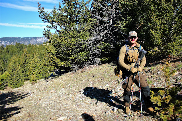
We ran to a couple of nice guys on our way and one let me took this photo of him. I hope he doesn't mind it, in case he or anyone who knows him, sees this. His face is not showing. He should be fine. Beside he is so nice, organized and neat. He should not mind being seen on the web, I'd assume
So we headed down and at about 08:00, if I'm not wrong, we were at a trail-head which was a tad off what I had on my map! I thought that little difference would not cause us any issue but it did! We took the available trail and basically headed south and southwest with the hope that we can find ourselves on the main trail with the help from the GPX Viewer. I saw a guy at the other side of the parking lot, when we were gearing up and was waiting to have an interaction with him and exchange words but the asshole walked off! I realized that his gear was different from us. It appeared that he was a hunter or maybe a poacher because the No Hunting sign could be seen at many spots on our way. Later, on the presumed(!) trail, we saw a guy was approaching in full hunting gear. I thought that was the guy we had earlier seen at the trail-head but I was wrong! It was another guy whom was joined by his friend shortly. We had a little talk and one of them gave a sort of water purification tablet to Stout which he never used! We carried on and after a few minutes we found the actual trail but considering we had spent at least 2 hours go get where we should have been only after half an hour(!), if we had parked at the right trail-head!, we decided head back! 
Stout was not very happy with this decision but that was eventually his. We headed back with the hope that we can find our footsteps and go back to the vehicle! Bad idea! There was no track of bread crumbs or such! The result was going up and down hills, bushwhacking, circling and you name it for at least, I'd say good 5 hours, if not more. I just gave up keeping the track of our time, eventually. Stout became very irritated and I sensed in his tone that he was really mad. He had told his wife that he'd be home by 17:00. It would only happened, if we had a helicopter in that situation! Fortunately once we were on the top of a hill discussing what to do, and I was trying to calm him, I realized that I had signal on my phone! It was unbelivable! We didn't get any signal when we were on Highway #22 even before Longview! I told him to check his phone (which later I noticed used the same service provider as I do, Rogers) and it was like he won lottery! He was so happy that he had connection and immediately called his wife and told him that we'd be home at around 21:30! I didn't have anyone to call! So it was not a big deal for me! 
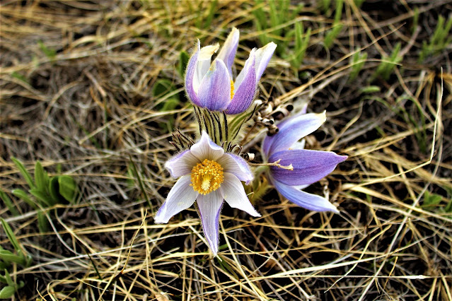
Spring has not fully sprung in Alberta yet but we saw many of these beautiful Crocuses in the area
At that point we decided to go back to the main trail, take it and go to the actual trail-head, where we were supposed to start our hike in the morning and go find the car from there but although he felt a better, he was still anxious and mad and was saying that he had been following me since the start without getting anywhere! I said: Listen. I have a few suggestion for you:
A- We can head down this trail, get to the trail-head and find our car, or
B- We can call 411 and ask for the telephone number of a local RCMP and discuss our situation with them!
" It's up to you ", I added. " You don't have just to listen to me ". Provide a solution and we can discuss that as well! That was my final word to him before he called 411 and we were put through Black Diamond RCMP non-emergency number! The lady at the other side, whom I was talking to, was very nice and helpful and told me to call 911 which in that way they would be able to see our coordinates and would come to get us. Stout, in the meantime, was nudging me to ask how much it would cost! Eventually, after hearing what the lady said, we decided to go with plan A!
I told him: Look. By the time the police of Search & Rescue gets here, we'd be at the car because we still had nearly 5 hours of daylight. He agreed and we carried on. We reached the actual trail-head in about 40 minutes or so and kept taking the assumed road where we found out that only would have been able to get it in the morning, if we had a 4x4! we would have had to park much further down. We kept walking and he was, at this point checking his Google Map which is available, partially, offline in situation like this and we realized we were not so far away from a gravel road which we were hoping to get us to the vehicle. We were both tired but he was way worse and we also were out of water. We reached a stream and he was hesitant to drink but I didn't give the second thought and drank a bit! The road ended where there seemed to be a fenced yard and cattle were everywhere, not to mention that we saw them all the way until there. We decided to have a break and think about the last segment of our journey! It appeared that we needed to go around the fence to get ourselves to the presumed gravel road. We were talking when all of a sudden I saw a big pickup truck with a trailer attached to it at the other side of the yard. I asked Stout, he was on the ground, lying(!) to wave at the guy and ask for help. I was sure he would either give us a ride or tell us how to get there. Stout jumped up and despite the fact that he was exhausted he tried(!) to run for the truck while waving his hiking poles! That was hysterical! The driver saw us and he drove to us. I joined Stout shortly and the guy agreed to give us a lift to the vehicle, although he said it was only a mile away. We were happy to jump back and we enjoyed a ride after 6 freaking hours of walking in the woods! Even when he stopped to get his dog in, which we don't know why it was running after the truck(!), we didn't mind it. We were at the vehicle in no time. We thanked him and I got his number because we're going back to make the summit and we will take a gift for him. 
Our first stop, on the way back was Longview. It was bit late and we couldn't go to a major restaurant, bar or cafe and Stout, who is a big meat-eater wanted to go to the jerky shop but it was closed after we came out from the Fas Gas convenience store to get beverages. Luckily the store had Beef Jerky, probably from the same store, and he bought 3 packs! I can't eat much eat because of my Gout but I tried a little piece and it was good. We headed north and he was waiting for the signal so he could send a message to his wife to tell her he would be late, again(!) because it was 09:30 and we still had another hour or so to go! This time he sent a message and put the telephone in his pocket!
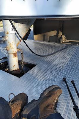
The ride in the back of the truck, with the trailer attached to it, even when the dog of the owner jumped up [which I don't have a photo of it here] was very pleasant
I don't remember when it was that we reached his home and left the rental and I drove home but I think I reached home almost around 23:30! Comparing it to the planned time that I was supposed to be home, 18:00, the latest, I was only 5.5 hours late! I took a shower and went to bed to be ready for tomorrow's work but what led to our unwanted adventure is relying on the unreliable GPX Viewer App on the phone, I think. I also think I should have taken a printed map and studied the area in more detail. We have a plan to go back in three month so I'm thinking of perhaps to buy a handheld GPS. What to do you think?
(Photo, top: Despite being in the area once and seeing the actual fire lockout on the top of Thrift peak, I thought that'd be the summit that we were about to make! It is not. Stout checked it out with my pair of binoculars and found a structure[!] there which we thought was the actual building. It is but not the one that we were aiming for. It could be Centre Peak which is further south but I'm not sure. I will make certain, if I ever decide to go!)