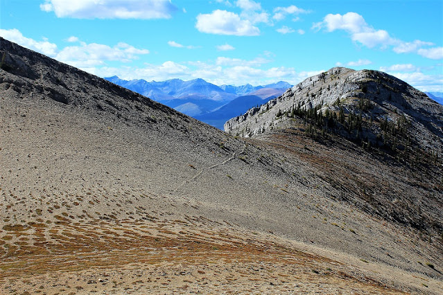
I finally was able to do a really good hike after more than 2 years and reach the summit. Two years is a long time and we just wasted most of that period because of the damn pandemic which is not over yet. This was the third hike of the year and initially I was supposed to go with my Mexican buddy but he excused well in advance. He said that he would not be able to take that day off due to staff shortage at work. I somehow ended up to go with a Canadian new buddy and this was a little unprecedented and I don't know how we ended up going together but we did! I suggested him to rent a car but he decided to bring his own. Fine by me. I always like to have a rental or someone else's car when I'm going hiking because of the milage that is put on the car and also at times we have to hit a gravel road.
He, to my surprise, came right on time, even 5 minutes earlier and that's what I liek about a hiking partner. We hit the road at about 06:35 hours and headed toward Sundre. It was such a beautuful road. All farms at both sides. Horses, sheep, catle, flocks of birds, all the natural beauty. We had a short stop at the Town of Sundre and then headed west. Maze Peak's trailhead is located between Sundre and Ya Tinda Ranch on 584 but then yo gotta turn south and follow the road parallel to Red Deer River.
I found the trail, based on the maps that I had already downloaded to my telephone we stopped at about 09:50. We quickly geared up and started our hike at 09:57. The first part of the hike is easy but then you rech a very steep slope which is covered in shale and it's not wise to go up because you take one step up and then you slide back down and the story continues. If it had been winter and there was good amount of snow and ice and of course we were equiped with reliable crampons, we would have gone up easily and gotten ourselves up the first ridge of the hike that we needed but we had to go to the side of that part of the mountain and approach the reidge form east or if you conider it a saddle, from it's back! There it becomes a bit easy. We continued to north, on the ridge and then from there, based on the map, I was able to see the summit (which was known later that it was actually the false summit!). We took a little brteak, had a few photos, drank some water and continued. After few minutes of easy hike to north, then the path, if you can find it(!), turns to east and first you do a little climb down and then you go up the actuall mountain which is your final destination but you don't know at that point that it's not the summit. I headed up and my hiking fella, whom I like to call Dodo(!) here followed me. There are a few cairns which assures you that you're on the right path to the summit. Dodo found them very interestinmg and considering that it was his first serious hike, I told him what he calls stone sculapture(!) is actually called cairn in mountaineering terminology!
I intentionally wore this wok boots(!) because they worked in Jasper and I was worried that if I wear my regulat hiking boots, I would have problem because of my Gout but instead the boots bothered me a lot and I even thought that I'd have blisters but fortunatelly I didn't get any. We took it easy for the rest of the trail and tried to be careful and slow. He was exhusted but he made it through and he even helped me with a bottle of water which helped me to spend the last half hour esier. I think it was about 18:25, if I'm not mistaken. Maze Peak is relatively easy to moderate hike with some route finding and scramble which defenitely worth trying. The good think about this hike was that we didn't see even one sole the entire time! Not even one! That's the kind of hike I like. You feel that the entire nature belongs to you. All of the details regarding the hike is easily accessible and available on the web but I will add a few here:
Elevation above the sea level: About 2400 m.
Elevation gain: Nearly 1000 m.
Hike duration: Between 6 and 7 hours.
(Photo, top: The camera is looking to west from the summit here. There are all the campgroudn that people go to enjoy the outdoors. Ya Tinda Ranch should be amongst them)


No comments:
Post a Comment